21 September 2010

Rishikesh – The Yoga Capital of India

At the foothills of the Himalayas along the banks of the sacred river Ganga, lies the town of Rishikesh. The first town this holy river reaches on its descent from the mountains, Rishikesh, is a town of many Ashrams and Hermitages and most major Ashrams including Vivekananda Ashram, Sivananda, Osho, Bihar School of Yoga, having their Yoga centers. Popularly adored for its scenic beauty dotted besides the holy Ganga, Rishikesh is traditionally known as the spiritual capital of the globe. Most of the temples and ashrams are on the banks of the Ganga at Rishikesh.
From the music legends like “The Beatles” to new age celebrities – everyone wants to come down to this city of Yogis and temples. During the mid-1960s, The Beatles visited Maharishi Mahesh Yogi Ashram (now closed) and several other artists, including Mike Love of The Beach Boys, Donovan and Gyp Mills, visited the site to contemplate and meditate. It seems modern Rishikesh experiences little shortage of people traveling from all over the globe in pursuit of enlightenment and spiritual bliss.
The city attracts thousands of pilgrims and tourists every year, from all parts of India as well as from around the world. It is also becoming a hot spot for white water rafting enthusiasts, both from India and foreign tourists, as it offers medium to rough rapids in the course of River Ganga.
Rishikesh represents the gateway to the Himalayas in the Garhwal region of Uttarakhand. The Char Dham Yatra (Four Shrines Sacred Journey) ideally begins from Rishikesh. Located at a height of 1360 feet above the sea level, it is believed that through the ages, the yogis and sages lived and practices penance here and it represents the site where Vishnu vanquished the demon Madhu Kaitav.
This holy town is 228 Km Northeast of  Delhi and 24 Km north of Haridwar and spreads on the right bank of holy river Ganga, at its confluence with the Chandrabhaga stream. The name Rishikesh is loosely applied to an association of five distinct sections encompassing not only the town but also hmlets and settlements on both sides of the river. These include Rishikesh itself, the commercial and communication hub; the sprawling suburban Muni-ki-reti or the “sands of the sages”; Shivananda Nagar, north of Rishikesh; the temple section of Lakshman Jhoola; and the assorted ashrams around Swarg Ashram on the east bank. You can reach the famous Neelkanth Maha Deva Temple from here.

The Yoga Capital

Rishikesh is internationally termed as Capital of Meditation and Yoga. The town is famous for its yoga sessions that are taught here by many yoga experts. The city has several yoga centers that attract domestic as well as foreign tourists. It is believed that meditation at the bank of river Ganga in Rishikesh brings one closer to attainment of salvation, or moksha, as it does a dip in the holy river that flows through it. 
The ancient art of Indian Yoga is very special, physical, breathing and spiritual exercises to get a perfect balance between the physical, psychological and spiritual health.
An annual international Yoga Week Festival is organized in Rishikesh, usually during the months of march . Leading spiritual leaders, yoga teachers, meditation teachers, naturopath doctors and thousands of devotees participate in the festival.


Some of the major ashrams and yoga learning centers at Rishikesh are:

Paramarth Niketan
Sivananda Ashram
Omkarananda Ashram
Vanprastha Ashram
Ve Niketan Dayanand
Vedanta Ashram
Vanmali Gita Yogashram


Winters last from November to march here, when temperatures fall below 5-6°C. The monsoons are generally experienced in the month of July and August. With introduction of river rafting on Ganges, adventure tours and increasing interest of people in traditional Indian activities like yoga, meditation and Ayurveda has made Rishikesh the preferred destination round the year.


14 September 2010

Pauri - A City Where Time Stands Still

Garhwal Himalayas have always been considered as a place where nature seems to have endowed all her innate loveliness.
The land of Pauri Garhwal is blessed with splendid view of snow-bound peaks of Himalayas, scenic valleys, surroundings, meandering rivers, dense forests and quaint hospitable people with rich cultural diversity. Diverse in topography, the district of Pauri Garhwal varies from the foothills of the ‘Bhabar ‘areas of Kotdwar to the soul lifting meadows of Doodhatoli, sprawling at an altitude of 3,000 m and covering as area of 5 sq. kms. There are several places to go and explore in Pauri Garhwal. This remains snow-bounded during the winter months. Filled with places of tourist interest, most locations in Pauri garhwal offer a breathtaking view of snow ladeb Himalayan splendour. The small hill town of Pauri is shaded by oak, deodar and pine forests.
The tourist complex offers a panoramic view of the innumerable known and unknown snow clad Himalayan peaks like Hatiparvat, Nilkantha, Choukhamba, Sumeru Parvat, kharchakujnd, kedarnath, Bhrigupanth, Jaunli, Gangotri group, Thalay Sagar, Bunderpoonch which is really breathtaking during sunrise and sunset. At sunrise the sun seems to be spraying colours on the mountain peaks which appear to be revolving continuously.

Best Time to Visit Pauri

Pauri is best visited between September and April or even all year ro0und. The monsoons cast a misty spell on the town, a sight worth seeing. If you want to see snow, then plan your trip around January.

How to Reach Pauri

Air: Nearest airport is Jolly Grant, Dehradun
(153 Kms –Via Srinagar; 130 Kms – Via Deoprayag)

Rail: Nearest railway station is Kotdwar (108 Kms)

Road: Pauri is well connected to Dehradun, Rishikesh, kotdwar and other cities of the region.

Where to Stay at Pauri

Tourist Rest House – GMVN                           Ph. 01368 – 222359

Forest rest House, Khirsu Res. Authority

Hotel Umesha                                                   Ph. 01368 – 223989

What to see at Pauri
Kandoliya Mahadev Temple:  A bewitching location, encircled by dense forests and towering peaks. A trek through forests will take you to the temple of the reigning deity kandoliya Devta.

Kyunkaleswar mahadev Temple: It is believed that the temple was constructed during 8th century A.D. It is dedicated to Lord Shiva. The solemn atmoshphere makes you meditative at this beautiful place.

Tara Kund: Situtaed at a height of 2,200m, tara kund is a picturesque spot amidst lofty mountains in the Chariserh Development Area.

Deoprayag – A Spiritual Metaphor

Devprayag is a beautiful showcase of traditions, myths and mysticism. This is a place where the holy rivers Bhagirathi and Alaknanda meet, making it a unique pilgrimage like the Prayag of Allahabad.
From here onwards two rivers merge into one and take the name of ‘Ganga’.
Deoprayag though situated just at an altitude of 618m from the sea level, is endowed with abundant natural beauty.
According to a belief, Lord Rama and his father King Dasharatha did penance here. The main temple is the ‘Raghunath Temple’ dedicated to Lord rama.
Devprayag a small town of Tehri Garhwal is a pilgrimage centre of great significance. In Treta-Yuga, Lord rama and Lakshman performed a yajna here to atone for killing Ravana, who was a Brahmin. The ancient Raghunath Temple here with a 15-foot tall deity of Sri-Rama (Sri Raghunath) is one of the 108 most important temples in India.


How to Reach Deoprayag

Air: The nearest Airport is Jolly Grant at Dehradun, 90 Km from Deoprayag.

Rail: The nearest railway station is at Rishikesh, 70 Km from Deoprayag.

Road: Deoprayag is well connected with Rishikesh and Dehradun and other parts of the Garhwal Himalayas.

Where To Stay at Deoprayag

Tourist Rest House – GMVN                           Ph: 01378-26013

PWD Inspection Bungalow

Dharamshalas of Kedarnath – Badrinath committee

Ramkund Resorts                                             Ph: 01378-266391

Places to see at Deoprayag

Raghunathji Temple: The ancient temple dedicated to Lord Rama, the epic hero of Ramayana. An impressive black granite statue graces the temple.

Barat Mandir: Relatively unknown, but this small temple is a beautiful example of hill temples. Named after Bharat, Rama’s younger brother. The bigger Bharat temple is at Rishikesh, but it is also much revered. Its worth visiting, to feel the pulse of Hindu mythology and beliefs.

Chandrashila: A gigantic boulder in the mid of Bhagirathi river at a distance of 2 Km from Deoprayag. According to legend, King Dashratha, father of Lord Rama meditated here for the salvation of his ancestors. A holy dip at this place, is believed to get one’s wishes fulfilled.

Chandrabadni: It is a small temple situated at the hilltop at an altitude of 2,756 mt above sea level at a distance of 30 Km from Deoprayag to Jamnikhal on the Tehri road. Reaching there by a trek of 1 Km you can have a breathtaking view of the Himalayan peaks and the river flowing below.

In the month of April, this sleepy corner of the hills bubbles with activities. A fair is held here, which sees devotees congregating from different parts of Himalayan region to witness the spiritualism revered in Chandrabadani Temple.

13 August 2010

Various Treks In Uttarakhand Garhwal Himalayas

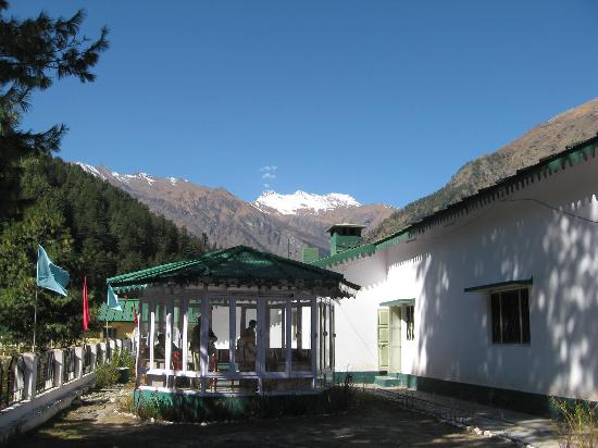
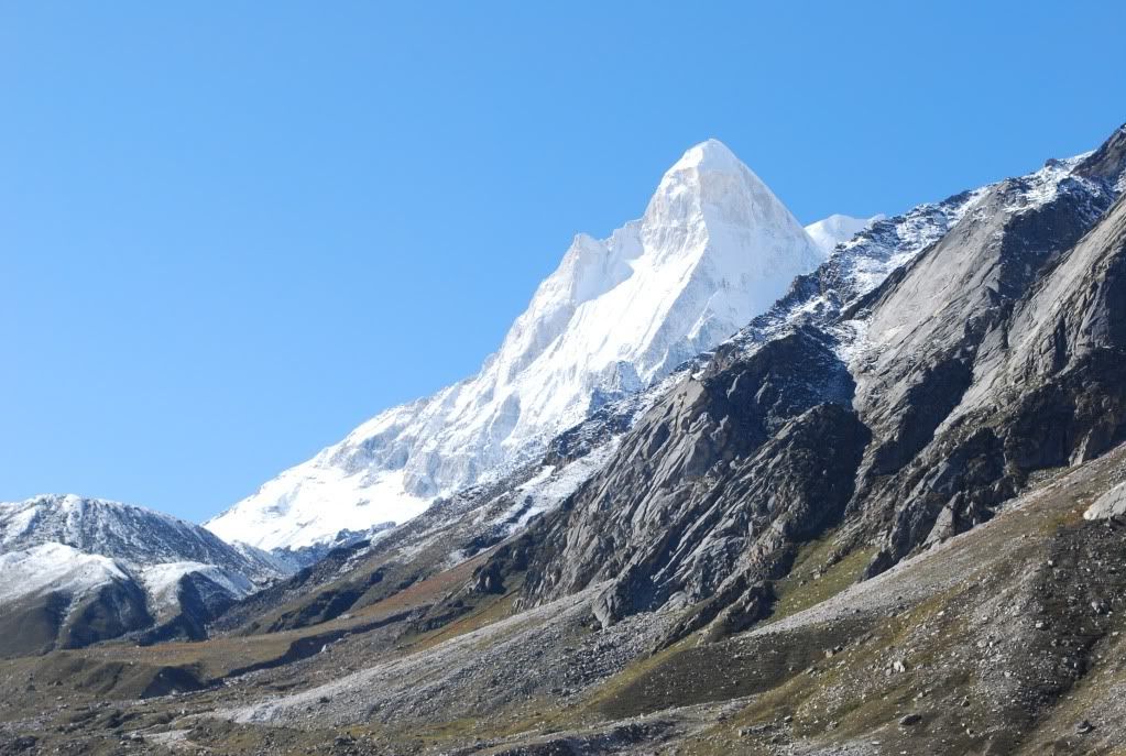
Kedarnath Vasukital Trek

Kedarnath is at an altitude of 3584m. 
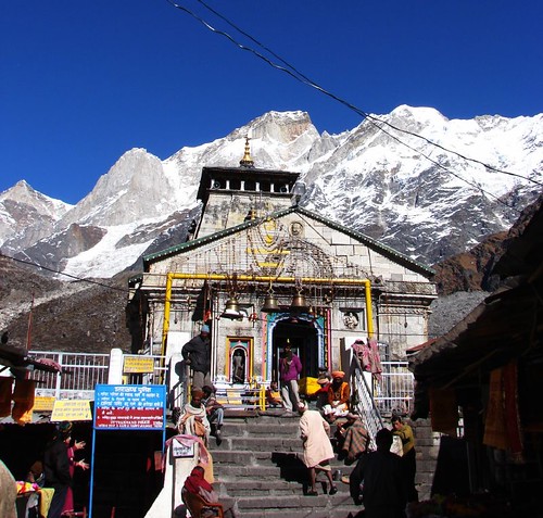
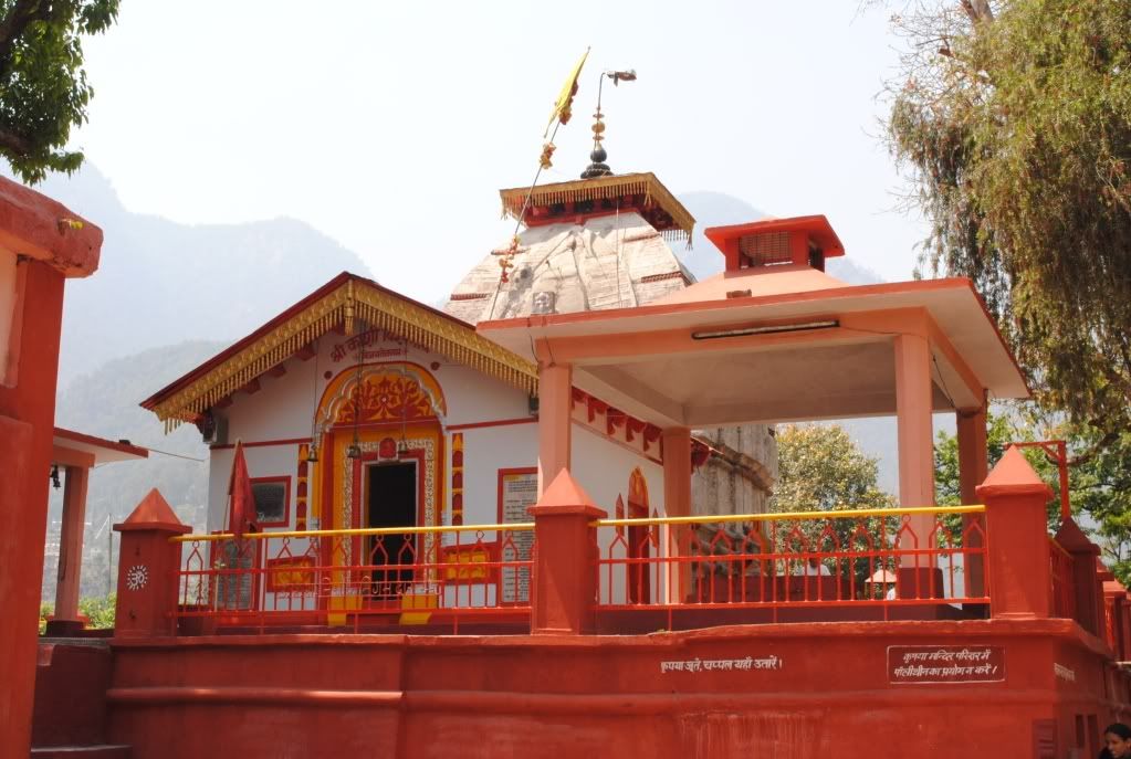
A magnificent temple was built by the Pandavas at the base of Kedarnath peak’s south-eastern face, and millions of pilgrims now come to offer their prayers to Lord Shiva.
The trek starts from Gaurikund, where there is a hot water Sulphur Spring. While approaching kedarnath, one passes through forests and comes across some beautiful waterfalls en-route. Kedarnath 
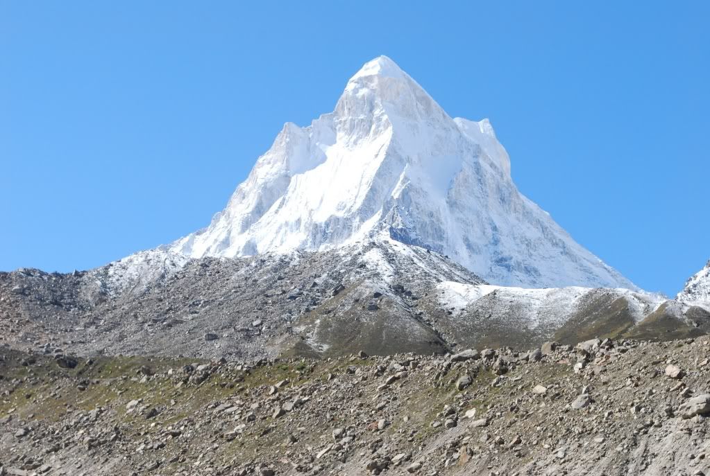
to Vasukital is a continuous ascent, offering a great trek. The view of Chaukhamba peak and Mandakini Valley is wonderful from here.
Vasukital Lake is about ½ kms in radius with crystal clear water.

Panch Kedar Trek - High Altitude

The Panch kedar trek includes all the five shrines associated with the legend. All of them are situated in the kedar valley. At kedarnath, which is situated at the head of mandakini River, the Linga is a natural rock that resembles the rump of a bull.
Madhmaheshwar is situated at the base of Chaukhamba peak at an altitude of 3500m. Here the Linga is worshiped in the form of a navel. Tungath where the arm of shiva appeared is the highest temple in Garhwal and is situated at an altitude of 3810m. 500 meters above the temple of Tunganath is Chandrashila. The panoramic view of the Himalayas is breathtaking from here. Rudranath is where the face of shiva had appeared. Here there is a natural rock temple, in which the shiva Mukha is worshipped. To rach Rudranath, one has to trek through alpine meadows and dense forests, crossing an altitude of more than 400m.
Kalpeshwar is situated in the beautiful valley of Urgam. There is a cave temple here, and shiva is worshiped in his matted hair form.

Kalindikhal Trek - High Altitude

This trek is for the more adventurous; with a fundamental knowledge of the mountains. It is an extension of the Nandavan trek, eastward to Ghastoli and then to Badrinath via Kalindikhal pass [5967m] the trek takes you from Nandanvan to vasukital after due acclimatization. From vasukital to Mana, the trek falls in the ‘inner line’. Do remember to take necessary permissions.

Gangotri Nandawar Tapovan Trek - High Altitude

Gaumukh is where the waters of Ganga tricke down from the glaciers. The sages called it ‘Gaumukh’, because in the distant past, it probably appeared like a cow’s mouth; though today, it no longer appears so. From Gangotri you move along the beaten track towards Chirbasa, which is on the treeline. From here you can have a clear view of the Bhagirathi peak Beyond Chirbase the terrain becomes really desolate and barren. In fact, it has been referred to as the Arctic Tundra by many trekkers. From Chirbase you reach Bhojwasa. Gaumukh Glacier is just four 
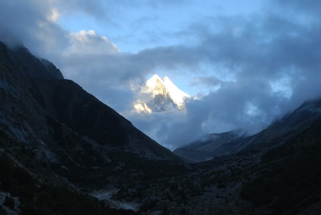
kilometers ahead. To reach Nandanvan, you take a detour from Bhojwasa. Here, you get the first glimpse of shivlinga peak, like an ice-cream cone rising towards the sky. Nandanvan is another day’s-trek ahead. From Gaumukh to Tapovan the ascent is steep, and as you climb the view of the surrounding peak becomes clearer. They appear to be just a stones throw away. Nandanvan situated at the base of the Bhagirathi group of peaks, and can be reached after crossing the Gangotri Glacier. It is an alpine meadow nestling in the shadow of the Bhagirathi peaks.

Dodital Yamunotri Trek - High Altitude

Dodital is at an elevation of 3024 meters above mean sea level. North of Uttarkashi. Crystal clear waters are surrounded by dense Oak woods, pine, Deodar and Rhododendrones. The lake is full of fishes and rare species of Himalayan Golden Trout. The forest surrounding the lake is also full of wild life. It provides an idyllic set up for rest and recreation activites like Angling, Boating and Bird Watching. From Dodital, it’s two day trek to Hanumanchatti via Darwa Top. Darwa Top provides a majestiv view of Himalayan Ranges including Bandarpoonch, Kala Naag etc.

Valley of Flowers Trek

T.G Longstaff and Frank Smythe for the outside world discovered this enchanting place by chance in 1931, though the local villagers of Bhundar Valley knew it as Nandankanan since time immemorial. They feared venturing into the valley, because of the spirts and faires that were thought to be haunting the beautiful valley. They feared that the spirits would carry them away. More than thousand varieties of flowers, ferns, and Himalayan herbs grow in the valley. The most beautiful of all Himalayan flowers, the Blue Primula can be seen blooming in thousands in the valley. The best time to see the valley in full bloom is mid- july to mid August. To reach the valley one has to trek from govind Ghat on the route to Hemkund Sahib upto Ghangaria, 14 KMS ahead. Few furlongs ahead of Ghangaria the trek route to the valley takes a detour towards left. The valley is about five kilometers from Ghangaria.

Khatling Sahasratal Trek

The Khating glacier is a lateral glacier, at the source of the river Bhilangana. Sahasratal and Masartal are on the west and east of it respectively. The valley of Bhilangana affords a panoramic view of snow capped peaks and hanging glaciers. Jogin group, Kirtistambha and Meru are sublime and magnificent. The entire trek passes through thick forests and beautiful lush green meadows in the beginning. Later, it crosses 2 passes above 17000 ft. and negotiates glaciers, morains and a snow patch.

Har Ki Doon Trek

Har-ki-doon, the hanging valley of gods is a treat for trekkers. This moderate-difficult trek takes you to one of the least explored regions of Garhwal. The best time to go for this trek is either june-july or October. The rest of the year is either very cold and wet, or the valley is mostly shrouded by clouds. The beautiful scenery and the glistening snow clad Swargarohini peak are the main attractions. As Har-ki-Doon falls within the Govind Pashu Vihar, Chances of seeing wildlife are very bright. In September-October, Chances of seeing wild flowers are also good.
Osla, one of the most beautiful villages in the Fateh Parvat region, should not be missed. Here, you have a beautifully carved temple dedicated to Duryodhana, the Kaurava Prince. And if you are interested in Glaciers than Jaundhar Glacier is just about 8 Kilometers from Har-Ki-Doon. It is a steep climb and requires some mountaineering skills. The glaciers is situated at an altitude of 4300m.
   

Roopkund Trek

Roopkund is situated at a height of 5029 in the lap of trishul massif. This is usually called the ‘Mystery lake’ since human skeletons and remains of horses were found here the lake, surrounded by rock strewn glaciers and snow clad peaks are magnificent and enchanting.

Uttarkashi Lata Budhakedar Pawalikantha Kedarnath Trek

This trek provides you with one of the rarest views of the entire range of Yamnotri-Gangotri-Kedarnath-Badrinath mountain peaks. In the process you pass through the seven bugyals of panwali Kantha, where if you are lucky. You might catch a glimpse of blue-mountain-goat. This trek is part of the ancient pilgrims’ traill from Gangotri to kedarnath, in the tradition of vamavrata yatra that began from yamunoti and ended at Badrinath, after paying respects at the Gangotri and Kedarnath shrines.

Kalsi Lakhamandal Trek

This is a cultural and historical trek in the Jaunsar-Babar region, at the foothills of the stately Garhwal Himalayas; between the rivers Yamuna and tons. The tribes here, known as Jaunsaris, practive polygamy and polyandry. The villages enroute are worth seeing for their cultural and architectural richness. The trek is rich with flora and fauna and is an unforgettable experience for ornithologists.

Kuari Pass Trek

Lord Curzon made the trek to kauri pass, and since then it has come to be known as Curzon’s trall. It is very popular among European and American travelers. In 1905, Lord Curzon reached Kurzon reached kauri pass from Ghat via Ramni. Today many trekkers prefer to undertake the trek in the reverse direction. They climb the ridge above Tapovan, and reach Gailgarh, where the trail coming bugyal through Gorson Top. The trek should not be undertaken in winters, as a major portion of the trail is covered with snow. The main attraction of Curzon’s trail is the majestic view of the twin peaks of Nanda Devi, Kamet, Dronagiri, and Hathi-Ghodi Parvat. Along the trek we’ll pass through pristine Rhododerndron, Oak, and Deodar forests. Rare Himalayan flora and fauna are aplenty on the trail. At Tapovan there is a massive sulphur spring. The wters of the spring are said to have excellent medicinal properties.

Binsar Trek

We reach Thailisain, via pauri, which is an enchanting township. From piersain and Binsar, a panoramic view of the stately Garhwal Himalayan peaks is visible. From Thailisain, the trek trails through very rich forests of Deodar, silver fir, Pine and Oaks; all brimming with wildlife. This trek is full of life and we can assure you will enjoy the scenic beauty throughout the trek.

Nagtibba Trek

Nagtibba, as the name suggests is the abode of the Nag Devta. The shepherds of the aglar valley on the northside of Mussoorie hills, known as jaunpur, come to this ridge top to worship the Nag Devta. Nagtibba offers an excellent view of the mountain peaks in all directions. To reach the top one has to pass through dense forest, and it advisable to take a guide, lest you get lost on the way. There is enough space for camping in the meadow, and the water source is nearby. Nagtibba can be climbed from two sides. Most trekkers prefer the pantwari side, which is a beautiful village symbolizing the culture of Jaunpur. From here begins the climb to the Nagtibba top. You can get down on the other side, to the village of Devalsari. From here the road head at thatyur is not thatyur and coming down at pantwari.

Devi-Darshan Trek

The trek is for those who wish to see Himalayan ranges but do not have the inclination for tougher treks. Three ‘siddh peeths’ – Chandrabadni, Surkanda Devi and Kanjapuri, are on top of hills in a triangular from, named after goddess Durga. From each temple the others are visible, and present a panoramic view of the mighty Garhwal Himalayas and the Doon valley.
Each temple is approachable by motor and by short treks of an hour each from nearest motor heads. Each temple at the top of the hills, deeply inspires you to transcend into mediation and spirituality.

Chandrashila Winter Summit Trek

It is a popular trek that can be undertaken round the year. Except during heavy snowing months of December and January. Chandrashila summit is a rock face above the temple of Tungnath, the highest of all the temples in the Himalayas. It is a short but rigorous hike beyond the temple. The Chandrashila summit affords the most beautiful view of the Nandadevi, Trishul, Kedarpeak and Chaukhamba peaks. If the sky is clear you get the feeling that you are sitting in a sea of mountains. So, start early in the morning and you might be able to catch a clear sky. The Oak forest through which you trek to the summit abounds in wildlife, especially foxes, pheasants, musk-deer, and leopards. But it is safe, as the animals keep away from the trail. We begin at chopta, which is one of the most mesmerizing alpine meadows in Garhwal Himalayas, whats more; it also offers excellent camping opportunities. And if we’re here in the month of March, there are good chances that as we climb from Ukhimath to chopta we may get the rare opportunity to see Rhododendron flowers in shades varying from crimson-red to bright white.

Bhadrai Jwala Devi Kempty Fall Trek

This trek has been specially crafted for the beginner & combines elementary trekking with some sight- seeing and picnicking. The climbs are not too difficult, and yet offer ample opportunities to the young explorer to soak-in the sight and sounds that nature bestows these hills with.

Rishikesh Auli Kuari Pass Tapovan Trek

As we approach Kuari pass through the Auli – Gorson Meadows, at an elevation of 4265m, we will be in the heart of Chamoli District, in the north eastern part of Garhwal. From Gorson, the imposing view of the eastern peaks of Garhwal Himamalayas is unforgettable enchanting. They appear so near, that one feels like reaching out and touching them. The peaks visible from kauri pass are Nandadevi, Dunagiri, Bethartoli, Devasthan etc.

Yamunotri Pass Ruinsiara Har-Ki-Doon Trek

The trek to Ruinsiara Tal can be taken from either the Har-ki-Doon side of from the Yamunotri side. From Osla we follow the trail that goes along a stream, until we reach a glaciar rivulet that passes through boulders, and leads into a birch forest. Following the trail, as it tends to turn left, we’ll find the Ruinsiara Tal on our left. The lake is hidden between a small ridge and the left wall of the valley. There is enough space to camp here; we’ll even find rock shelters to protect us from that surprise shower. The trail further goes up to the Bandarpunch Base Camp, from where an excellent view of the Bali pass can be enjoyed. The trek route from Yamunotri Pass, situated 12 kms ahead of Yamunotri, goes through dense forest and is somewhat difficult compared to the route form Osla to Ruinisara.

Nandadevi National Park Trek

This is the last human inhabitation on this trekking route. Trekkers are given an exposure to their unique culture and customs of the region.
The first day of actual trekking is probably the toughest and invo9lves a steep ascent of almost 1524m, with a break at Belta. This stretch can be anything from 6 to 10 hrs. depending on the trekkers. However it is an excellent stretch for acclimatization. The next day, one wakes up at dawn to breathtaking view of Mount Bithartoli-Himal (6354m), Nanda Ghunti (6309m), Ranthi Peak (6003m), Dronagiri (7066m) and the vast view of Kuari pass, Auli Urgam Valley and lata village. The trek to Dharansi pass begins with a steep clim upto jhandi Dhar and further up to Bagfyana pass. From here the trail passes through a very narrow gorge of Satkula with steep ascents and descents and finally one arrives at the meadow of Dharansi.
On day 6, the beginning of the trail upto Doni Dhar is a gradual descent and then onwards to Debrugheta is a steep descent of 750m till one crosses to the improvised bridge over the stream.
The return trek takes a different rout from Handi Dhar, and goes on to Hitoli camp site. This stretch passes through rich forests of rhododendron, birch and ragafur.
Nanda Devi Nation Park, the greater area Containing the sanctuary and home to Bharals, snow Leapord, Musk Deer, Himalayan Deer and hundreds of species of birds, was closed for human beings in 1982 to protect its deteriorating bio-diversity. With no human intervention, the bio-diversity became richer and now, the NDNP has been declared a world heritage site. It has also been partially opened to a restricted number of trekkers. The visitors to NDNP can move only in groups and each group consisting of no more than 5 people. Not more than 2 groups are permitted in a day and no more than 4 groups permitted in a week. One registered guide will accompany every group of 5. The park is open from the 1st may to 31st October
It is mandatory for the trekkers to obey and observe all the provisions wildlife protection act inside the park area.

Adi Kailash Trek

Mount Adi Kailash also known as Chhota kailash, is an ancient holy place in the Kumaon Himalayas, quite similar to mount kailash in Tibet. It is situated close to the indo-Tibet border in pithoragarh district. The trek begins and ends at Mangti. The first five days of the trek are on the same route as the pilgrimage to mount kailash and Mansarovar. In the last village in this valley, kuti, one gets to see the Pandava fort, natural salt mines and intricately engraved doors and windows of the village houses. The last stretch up to Adi kailash also known as Jolingkong is only 14 kms from kuti. In close promimity os parvati Tal, with Shiv Parvati temple on its shore. This route offers breathtaking landscapes and panoramic view of the mountain ranges of kumaon Himalayas, the snow capped Api and Nampa, the gushing Kali river, Bhojpatra forests, the serene Narayan Ashram as well as numerous waterfalls.

Milam Glacier Trek

The base camp for Milam Glacier is Munsiyari [2290m], in Pithoragarh district. From Munsiyari, the trek to Lilam is mostly downhill along the Gori Ganga river. Enroute Bugdiyar to Riekot is a thickly forested area from where the land opens into the Gori Ganga valley. After crossing the Gori Ganga River, and below Burfu village, one gets an uninterrupted view of the nanda devi and Hardeol peaks, right upto Milam glacier. The Milam glacier summit at 3872m is the nodal point for a different high grade routes and peaks. The main peaks are Hardeol (7151m), Burphudhura (6215m) and Kalabulanddhura (6215m).

Dindari Glacier Trek

The most easily accessible glacier in the kumaon region, the pindari Glacier has a beauty of its own. Situated between the snow-capped Nanda Devi and Nanda kot Mountains.
As one trek along the route surrounded by the majestic Himalayas, every inch becomes a fresh song of nature and at every curve the eyes embrace a new landscape more beautiful than before, Reading the upper levels. The trees fall off, the pines cease and the road enters an enchanted garden of fern, wild flowers ands rhododendron. The glacier, over 3.2 kilometers in length and 1.5km broad, backed by mighty mountains, loom-up on the traveler with a gorgon gaze, leaving an indelible impression of grandeur, situated on the Nanda Devi and Nanda kote peaks, it extends from 3520m to above sea level, on an open, undulating piece of ground. To the east is a lofty moraine constituted of gravel, mud and blocks of snow embedded in ice a ground past, over the glacier, at a height of 5393 metres leads to the Trails’s pass. A trip to the Pindari Glacier is well within the capacity of any trekker, amply rewarded by magnificence of the mighty Himalayas. 

Kafni Glacier Trek 

Kafni glacier is situated on the left side of Pindar valley under majestic mountain Nandakot. This region has its own charm with the solitude it presents. This region is very rich in wildlife. There are no rest houses beyond Dwali and one has to spend nights in tents or caves. Main peaks near the glacier are Nandakot 6860 meters, Nandabhanar 6104 meters.

Sunderdhunga Trek

This valley is on the right side of Pindar valley. Sunderdhunga literally means valley of beautiful stones. The famous glaciers of this valley are maiktoli Glacier (6804 M) and Sukhram glacier and main peaks are Tharkot (6100 M), Mrigthuni (6856 M), Maiktoli (6804 M) and Pawali Dwar (6663 meters). The route to sunderdhunga is the same upto khati as is for the trek to Pindari and kafni.

Danchachuli Glacier Trek

From Jatoli upto Dhunia Dhaun, about 8Kms is a tough trek. One should spend the night in Dhungia Dhuan either in shepherd huts or in pitched tents. One hundred and thirty four kilometers from pithoragarh and 35 Kilometers from Dharchula is the last bus terminal sobla. From sobla to panchachuli Glacier is a 40-kilometer terk. The route to the glacier abounds in exotic scenery, snow-capped mountains, gushing streams, alpine meadows and a rich variety of flora & fauna. And from the glacier one can see the panchachuli peaks in their towering glory. On the final lap at village Duktu/Dantu one gets the majestic spectacle of panchachuli that derives its name from the five peaks, named after the legendary pandavas. The interesting part of this trek is that the trekkers will be sojourning in the traditional houses of the local people and will have a face to face interaction with the indigenous culture and local tradition.

Nanda Devi East Face Trek

Base is the most exciting Himalayan trek cum expedition. The trek goes along Gori Ganga river upto Reilkot. From here to Martoli is 7 Kms. The Nandadevi (East) Base Camp Situated at Bhiltalgwar (4350m) below Nanda Devi and one can see trail pass. Nanda Ghunti and Long Staff peaks. Nanda Devi base camp is about 63 kms from Munsiyari. Other route of Nanda Devi east face is 6 kms from Ganghar, which is 12 km fro Reilkot.

13 April 2010

Mussoorie - The Queen of Hills

Mussoorie is a beautiful hill station in Uttarakhand Gahwal. It is approximately 25 Kms from Dehradun. Mussoorie is termed as Queen of Hills (paharon ki rani) because of its immense beauty and natural fragrances. Without doubt Mussoorie is the Honeymoon Capital of North India. Summer or winter, our eyes are gladdened by the invariable attractive couples walking hand in hand down the Mall, planning their lives together. This Queen of Hills was established by the British as a 'Rest & Recreation' station. The snowfall here, usually in the end of December and beginning of January, attracts visitors by the thousands.

Other Sites Near Mussoorie
There are so many other beautiful places to go near Mussoorie. People who come to visit this Queen of Hills do not miss the chance to view the immense beauty around Mussoorie.

Kempty Fall
15 Kms from Mussoorie on the Yamunotri road having an altitude of 1215 mts, it has the distinction of being the biggest and the prettiest waterfall located in this beautiful valley and is surrounded by high mountains. A bath at the foot of the fall is refreshing and enjoyable for children and adults as well.

Dhanaulti
Located amidst thick, virgin forest of Deodar, Rhododendron and Oak, it has an enchanting atmoshphere created by a long wooded slopes, relaxing outdoors, cool caressing breeze, warm and hospitable inhabitants, and a fabulous view of snow covered mountains. All this combine to make Dhanaulti as ideal retreat for a relaxed holiday. Situated on the Mussoorie - Chamba route, Dhanaulti is just 24 Kms from Chamba.

Surkanda Devi
Mountain - top Surkanda Devi temple, at an altitude of 2903 mts, and ringed by dense forest, is a sanctified spot. People from all corners throng to this shrine and the Ganga Dussehra Fair held every year between May and June attracts thousands of devotees not only from Garhwal but other parts of Northern India as well. For reaching this temple one has to walk 2 Kms from the motor road at Kaddukhal which is 22 Kms from Chamba and 7 kms from Dhanaulti.

Haridwar - The Way to God

Haridwar is the one of the most sacred place on the earth. Haridwar itself means Hari-Ka-Dwar i;e, way to God. Haridwar is a beautiful city located at the bank of river Ganga. This beautiful divine city is full with temples and Ashrams.


Tourist Rest Houses

Rahi - Haridwar
Rooms : 20 (AC-3, Deluxe-16, Family Suite-1

Services & Facilities: Lawns, Canteen, Room Service

Operating Season: Round the year

Best season to Visit: Round the year

Nearby Attractions: Aarti Darshan at Har-Ki-pauri, mansadevi Temple, Chandi Devi Temple, Daksh Prajapati, Kankhal, Rajaji National Park, Chilla

11 April 2010

Harsil - The Nature's Blessings

Harsil is an unexplored beauty of Garhwal Himalayas. Situated on the way to Gangotri, at a distance of nearly 75 Kms from Uttarkashi, this sleepy hamlet offers immaculate beauty of the Himalayas, at an impressive height of 2620 meters above the sea-level. It is surrounded by the breathtaking splendour of the majestic Himalayan peaks.

Harsil is also known as a major apple growing Zone. A Britisher, Mr. Wilson planted here the first apple tree in the 19th Century. His Cottage was still a major attraction in the area till a major fire destroyed the cottage.
Situated amidst the incredible beauty of mountain peaks, Harsil is counted amongst some of the most beautiful places in the Garhwal region.
Harsil has a cool climate throughout and gets snow bound between December and March.

Harsil is a cantonment area. So, it is restricted for the foreign tourists. Apart from being at the way to Gangotri, it's also the entry point to the Kinnaur Himalayas in the Himachal Pradesh.

How to Reach
Air: The nearest Airport is Jolly Grant, 260 Km away.
Rail: The nearest railway station is Rishikesh, at a distance of 245 Km.
Road: Harsil is connected with the outside world through motorable roads, via Uttarkashi.

Places to Stay (Hotels in Garhwal)
Tourist Rest House - GMVN Ph: 222210


PWD Inspection House
Mini Swiss Hotel

There are several Private Hotels in Dharali, 03 Kms from Harsil. Some of them are mentioned below:

Hotel Shivalik
Hotel Aanchal
Hotel Chandralok
Hotel Snowpinch
Hotel Himgiri

View Full Album of Harsil @ Garhwal Darshan - Album

13 March 2010

Panchakarma - The Ayurvedic Secrets Of Cleansing The Body & mind


Panchakarma is super specialty Ayurvedic therapy. It means five therapies, the Ayurvedic means of maintaining the equilibrium of mind and body. This therapies help in eradicating the toxic substances accumulated in the body. It is a treatment for both the healthy and the unhealthy. The five therapies of Panchakarma are: Vamana, Virechana, Basti, Nasya and Rakta Mokshana.
Why Panchkarma?
Due to the nature of modern lifestyle, food habits, diseases etc. invariably our body becomes a dumping ground of unlimited toxic and waste substances. By means of Panchkarma Procedures the toxins lodged even at the lower layer of the body are flushed out and eliminated. These treatments often bring out the deep-rooted origins of the diseases to the surface where they can be treated and cured

Benefits
  • Eliminates Toxic matter from the body 
  • Enhance the power of digestion and metabolism 
  • Gets rid of diseases from the very root of the system 
  • Restore normal health
  • Helps the body gain strength and increase virility
  • Gives a clearer complexion

Different Types of Purification Rejuvenation Therapies 

Abhyangam or Ayurvedic Massage: This is a special type of massage in which strokes are given according to the circulatory channels with medicated oil for 45 minutes per day for 7 to 30 days. Useful in: obesity, loss of skin luster, to correct blood circulation, sleeplessness, fatique and other vata predominant diseases.

Snehapanam: In this treatment medicated ghee or oils are given internally in proportionally increasing quantity for a period of 5 to 7 days. Useful in osteo arthritis, psoriasis, chronic constipation, hemorrhoids, general weakness etc.

Vamana: in this therapy week of preparation like snehpanam & swedanam very useful in kapha predominant diseases like upper respiratory problems’ mental & serious skin diseases like psoriasis.
Virechana: after one-week snehpanam and swedanam the purgation is induced with some special Ayurvedic medicine. This is very useful in pitha predominant diseases like acidity, Chronic constipation etc.

Pizhichil: Luke warm herbal oils are applied all over the body of the patient by two therapists is special rhythematic way continuously for about 1 hour in a day for a period of 7 to 21 days. This treatment is very useful for rheumatic diseases.

Sirodhara: In this process some herbal oils, medicated milk; medicated buttermilk etc. are poured on the forehead in a special method for about 45 minutes in a day for a period of 7 to 21 dyas. It is useful in insomnia, loss of memory, headaches, mental tension and certain skin diseases.

Vasthi: is a therapeutic procedure in which certain herbal oils, herbal extracts etc are applied through the rectum daily for a period of 7 to 30 days. It is useful in arthritis, paralysis, hemiplegia, gastric complaints, rheumatism, chronic constipation, sexual weakness and general weakness.

Sirovasthi: Certain lukewarm herbal iol are filled in a siro vasti yantram fitted on the head and held for 15 to 60 minutes per day according to the patient’s conditions for a period of 7 dyas. Beneficial in facial paralysis, dryness of nostrils, mouth or throat, severe headaches and other diseases of the head and for mentally retarded children.

Nasyam: it is a treatment in which herbal juice, medicated oils etc. are applied through nose for 14 dyas. This treatment is highly effective in certain types of headache, paralysis, mental disorders and some skin diseases etc.

Kizhi: Herbal leaves or powders are made in boluses and is applied on the whole body or a part specified after dipping it in warm medicated oils. This procedure is done for 45 minutes daily for a period of 7 to 14 days. It is benefical in osteo arthritis, spondylitis, sport injuries etc.

Dhanayamla dhara: Warm herbal liquid is poured all over the body is rhythmic way using a special vessel. This is done for 45 minutes to 1 hour daily.

Yoni Prakshalanam: Herbal oils and decoction are applied through the vaginal route. This treatment is good for gynecological disorders. It is also purification process of the genital organ.

Kativasthi: in this process specially prepared warm medicated oils is kept over the lower back with herbal paste boundary. This treatment lasts for 45 minutes to 1 hour and it is good for any type of back pain and spinal disorders.

Urovasthi: Like kativasthi warm medicated oil is kept over the chest for 45 minutes. This is an effective treatment in asthma, other respiratory problems, heart diseases and muscular chest pain.

Medicated steam bath or Vaspswedan is an important process prior to main panchkarma therapy. It is useful in the detoxification and purification of whole body.
    
      A team of doctors and staff at the GMVN panchkarma centres have been duly trained in panchkarma   
      protocols and in health care management.These centers offer a unique combination of Ayurveda, Yoga,
      Panchakarma, Kerala specialty and for rejuvenation with Himalayan herbal specialty.

20 January 2010

Uttarkashi - The Kashi of Uttarakhand

Uttarkashi is situated at an elevation of 1158 m, on the bank of river Bhagirathi. This is an important pilgrim center equated with Banaras of Kashi, in divinity. The town is situated between Varuna and Assi streams, with ghats bearing the same names as those in Kashi. The temple of Lord Vishwanath is located here, alongwith other important temples like Shakti Mandir, Kuteti Devi, Kali Mata etc.

Places to Go in Uttarkashi

Nachiketa Taal

Nachiketa taal is located at a distance of nearly 32 kms from Uttarkashi. Nachiketa taal is a trek of 3 Kms from  Chaurangikhal. It is a beautiful place with a lake surrounded by a dense forest. Most of the local people prefer to visit this place frequently on holidays. Especially in winters people from Uttarkashi visit this place to enjoy the experience of snowfall. During winters (December to March) this place is mostly covered with snow. TNachiketa taal is called so after the name of the Saint Nachiketa who is believed to be the creator of this lake. Various trekkers prefer to stay near the lake - Nachiketa taal for few days and thus carry their own tents and other necessary things.

Gangani
Gangani is noted for its thermal springs, where one can take a bath for relaxation and rejuvenation. Its is a small paradise with a spectacular view and tranquil surroundings, offering peace and solitude. Pilgrims heading towards Gangotri usually takes a bath at this divine thermal spring of Garhwal before going to Gangotri and in the return trip as well.

Harsil
Getting its name from Hari Shila temple, harsil is situated at a distance of 73 Kms from Uttarkashi on the way to Gangotri. this sylvan hamlet is famous for its natural beauty. Situated amidst the incredible beauty of mountain peaks at 2620 m, it is a quite resort to discover the undiscovered stretch of green grassy land and enjoy the surrounding. More details on Harsil can be found at my detailed post on this glorious place at Harsil - The Nature's Blessings.

Bhairowghati
On the way to Gangotri, Bhairowghati is the place to stay and enjoy the mountain landscape. A temple dedicated to Bhairow Devta is visited by scores of pilgrims, for he is the lord of the gateway to Gangotri.

Chirwasa
9 Kms from Gangotri, Chirwasa is a beautiful site. This popular camping site offers glimpses of the glaciated heights of Gaumukh. 14 kms further from Gangotri, Bhojwasa is famous for its Bhojpatra trees. The barks of these trees were used in the medieval ages to write on. Legend has it that the Veds and Purans of Hindu mythology have all been written on Bhojpatra from these forests. 

Gaumukh
The Gangotri glacier, situated at an altitude of 4255 m, is nearly 24 Km in length and 6-8 km in width. It starts from beyond the Chaukhamba cluster of peaks in the neighborhood of Badrinath and extends as far as Gaumukh. It is generally accepted as the physical source of the holy river Ganga. It is held in high esteem by the devotees who do not miss the opportunity to have a holy dip in the bone chilling waters of the glacier.

Tapovan and Nandanvan
These two spot are situated opposite the Gangotri glacier, further up from Gaumukh. Nandanvan is the base camp of Bhagirathi peaks from where the visitors can have a superb view of the majestic Shivling Peak. the trek across south of Gangotri glacier leads to Tapovan, known for its beautiful meadows that encircle the base of shivling peak.
Related Posts with Thumbnails

Sponsored Ads